Our Professional Survey Services

Surveyor Topographer provides comprehensive topographic surveys, measured surveys, and land survey services throughout the UK. Our experienced team uses highly specialised survey equipment and modern surveying technology to deliver accurate survey data for property buyers, architects, developers, and civil engineering projects.

Topographic survey using GPS equipment and surveying technology

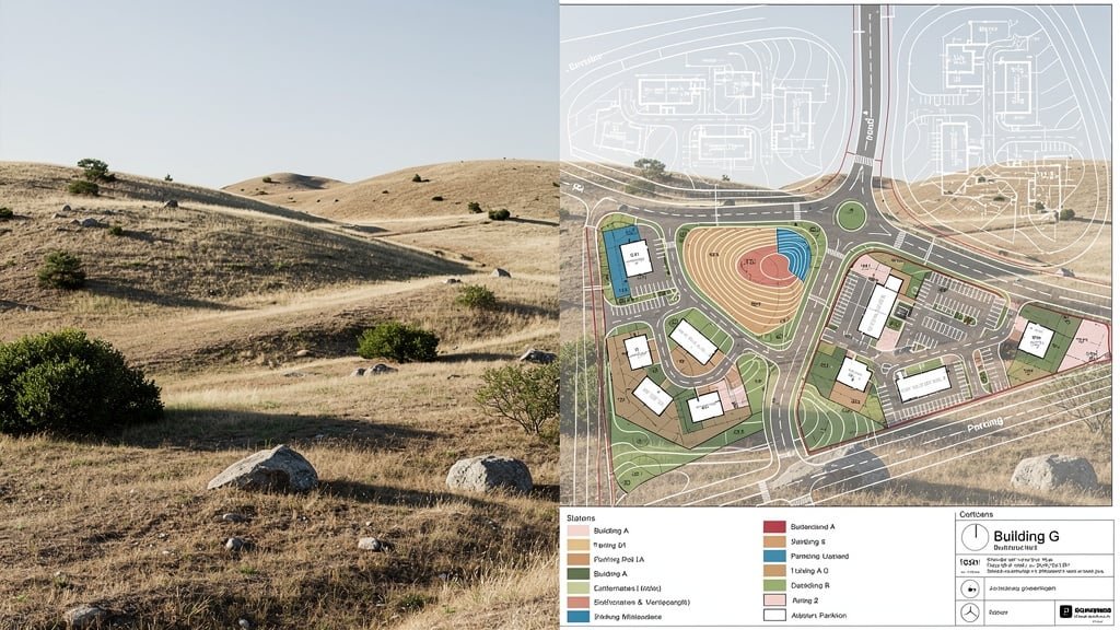
Topographic Land Survey

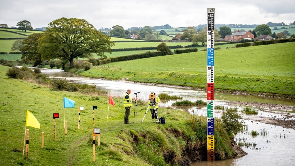
A topographic survey is a detailed mapping of an area of land showing natural and man-made features, contour lines, spot levels, and the elevation of the land. This type of survey is essential for architects, planners, and developers who require accurate topographic data for land development and construction projects.

What Does a Topographic Survey Include?

  • Detailed CAD drawings showing all natural topographic features and manmade structures
  • Contour lines indicating changes in elevation across the land
  • Spot levels at key points throughout the survey area
  • Location of trees, vegetation, and natural topographic features
  • Positions of buildings, walls, fences, and other structures
  • Drainage features, water courses, and flood risk areas
  • Underground utilities and services where accessible
  • Ordnance Survey grid references and survey control points

Benefits of a Topographic Survey

Getting a topographical survey helps prevent costly mistakes and unforeseen issues during construction. Our topographic surveys provide architects and engineers with the accurate land data they need to design appropriately for the site's topography. This ensures your development project can be planned efficiently and submitted for planning permission with confidence.

Request a Quote

Measured Survey Services

A measured survey provides precise measurements of existing buildings and structures. Using total station equipment, laser scanners, and accurate GPS equipment, we capture detailed internal and external dimensions for property development, renovations, refurbishments, and as-built documentation.

Applications for Measured Surveys

  • Building refurbishment and renovation projects
  • Property extensions and conversions
  • As-built surveys for construction verification
  • Building Information Modeling (BIM) projects
  • Heritage building documentation
  • Commercial property assessments
  • Space planning and fit-out design

Survey Process

Our survey team visits your property or land to carry out the survey using highly specialised survey equipment. The survey data is then processed to create comprehensive CAD drawings that architects can use directly in their design work. Our measured surveys provide the level of detail necessary for local authorities and planning permission applications.

Get Started
Surveyor using total station for measured survey
Land survey for development planning with CAD drawings

Land Survey & Boundary Surveys

Our comprehensive land survey services help property buyers and sellers understand their land boundaries, resolve disputes, and plan for development. We provide accurate land surveying that integrates with Ordnance Survey mapping to give you a complete picture of the land.

Land Survey Services Include:

  • Boundary surveys for property disputes and sales
  • Site surveys for construction project planning
  • Topographic land surveys for development sites
  • Agricultural land surveys
  • Utility mapping and services location
  • Setting out surveys for construction
  • Monitoring surveys for structural movement

Why You Need a Land Survey

A professional land survey ensures you have accurate data about your property or land before making important decisions. Whether you're purchasing land, planning development, or resolving boundary issues, our land surveyors provide survey results you can trust. We use modern surveying technology including accurate GPS equipment to ensure precision in every survey.

Book Your Survey

Drone Survey Technology

Modern topographical surveys increasingly utilize drone survey technology to capture data quickly and safely. Our drone surveys provide aerial perspectives that traditional surveying methods cannot match, making them ideal for large areas of land, difficult terrain, or sites with access restrictions.

Advantages of Drone Surveys

  • Rapid data collection across large survey areas
  • Access to difficult or dangerous terrain safely
  • High-resolution aerial imagery and mapping
  • 3D modeling and volumetric analysis
  • Cost-effective for extensive land areas
  • Minimal disruption to site operations
  • Progress monitoring for construction projects

Our drone survey services complement traditional surveying technology, providing comprehensive topographic data that captures every detail of natural and manmade features. The resulting survey data integrates seamlessly with our CAD drawings and can be used by architects and engineers for detailed planning.

Enquire About Drone Surveys
Drone survey technology for aerial topographic surveys
Flood risk assessment and topographic survey for land development

Flood Risk Assessment Surveys

Understanding flood risk is crucial for property buyers, developers, and those seeking planning permission. Our topographic surveys include detailed elevation data and drainage information that can be used for flood risk assessment. We survey the area to provide accurate spot levels and contour information essential for evaluating how water flows across your land.

What Our Flood Risk Surveys Provide:

  • Detailed elevation of the land and surrounding area
  • Drainage patterns and water flow analysis
  • Identification of natural watercourses
  • Spot levels for flood modeling
  • Integration with Environment Agency data
  • Support for drainage design and planning

Local authorities often require flood risk assessments as part of planning permission applications, especially for construction projects in areas with potential flooding concerns. Our topographical land surveys provide the foundational topographic data needed for comprehensive flood risk analysis, helping you avoid unforeseen issues and costly mistakes.

Discuss Your Requirements

Why Choose Our Survey Services

When you require a topographic survey or any survey services, Surveyor Topographer delivers the importance of topographic surveys with professionalism and precision.

Professional Accreditation

All our topographical surveyors are members of CIOB, RICS, and RPSA, ensuring every survey meets industry standards and provides accurate survey data you can rely on.

Latest Survey Equipment

We use highly specialised survey equipment including accurate GPS equipment, total stations, laser scanners, and drone survey technology for comprehensive survey results.

Detailed CAD Drawings

Receive professional CAD drawings showing natural and man-made features, contour lines, spot levels, and all survey control information ready for architects and engineers.

Fast Turnaround

Understanding that construction projects have tight deadlines, we complete the survey process efficiently and deliver topographic data promptly without compromising quality.

UK-Wide Coverage

Our survey team provides services throughout the UK, conducting topographic land surveys for property or land in urban, suburban, and rural locations across the nation.

Expert Support

From understanding what type of survey you need to interpreting survey results, our professional topographical surveyors provide expert guidance throughout the survey process.

Need a Topographic Survey for Your Project?

Whether you need a topographic survey for planning permission, a measured survey for renovations, or a land survey for property purchase, our survey company is ready to help. Don't let unforeseen issues impact your construction project—get accurate land data from experienced land surveyors.

Request Your Free Quote Today